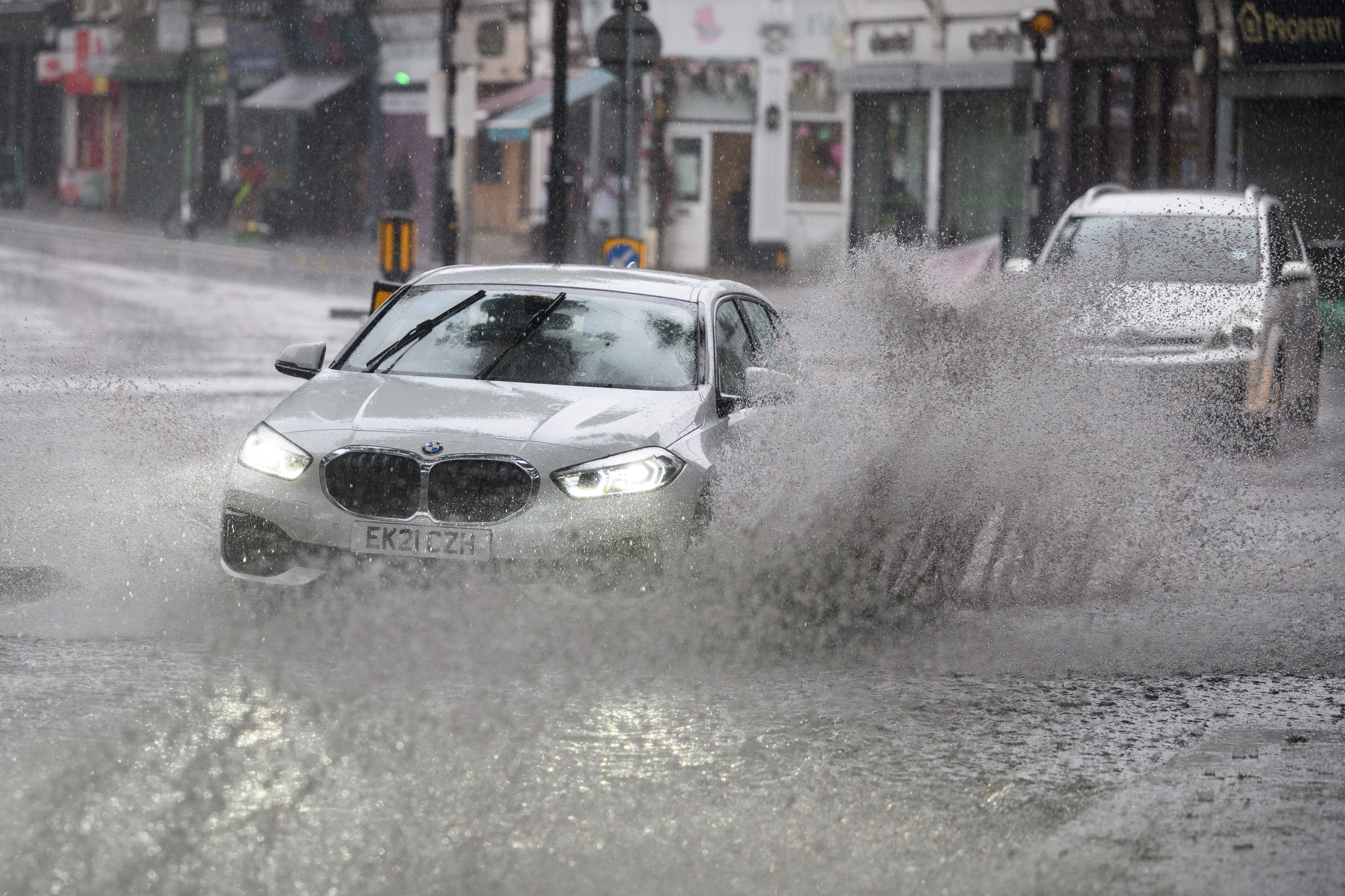
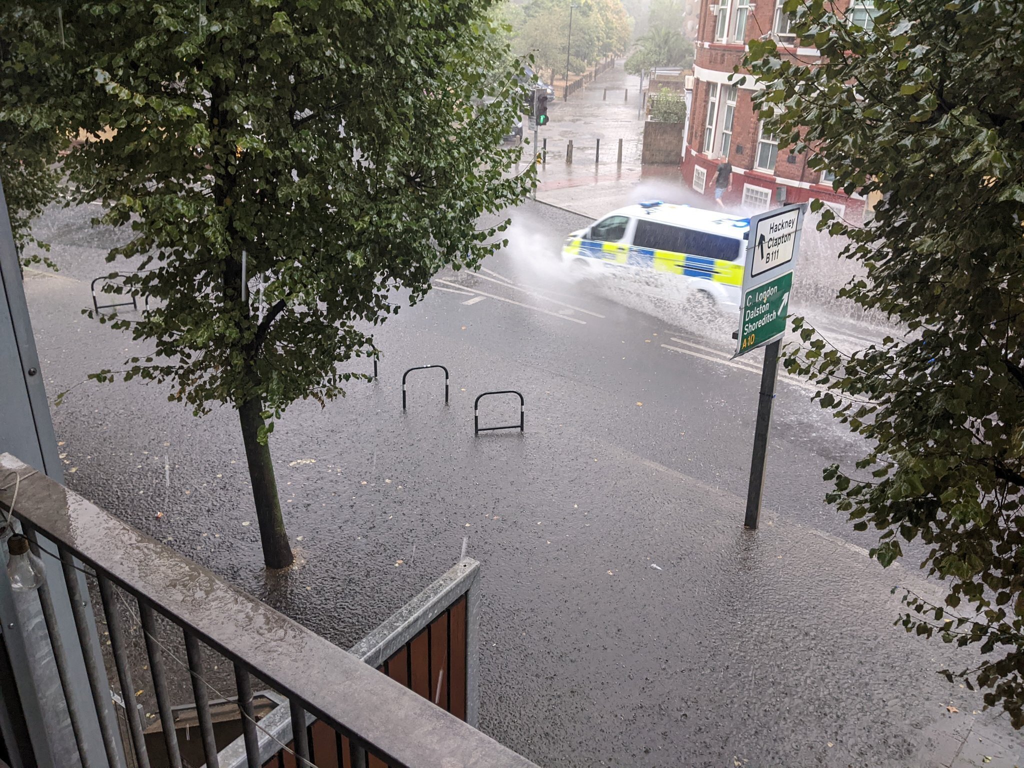
Parts of the UK have faced two days of torrential rain, which follows weeks of hot weather and sunshine, with a thunderstorm warning covering most of the south east of England, including parts of London, in place.
While the weather extremes may be disconcerting, one invariably leads to another. With land left parched, it will take heavy rain much longer to be absorbed into the ground – leading to the spate of flash floods being recorded on social media.
And the downpours will not magically solve the country’s drought problem. The Environment Agency has said it will take weeks of rain to replenish water sources and end the drought.
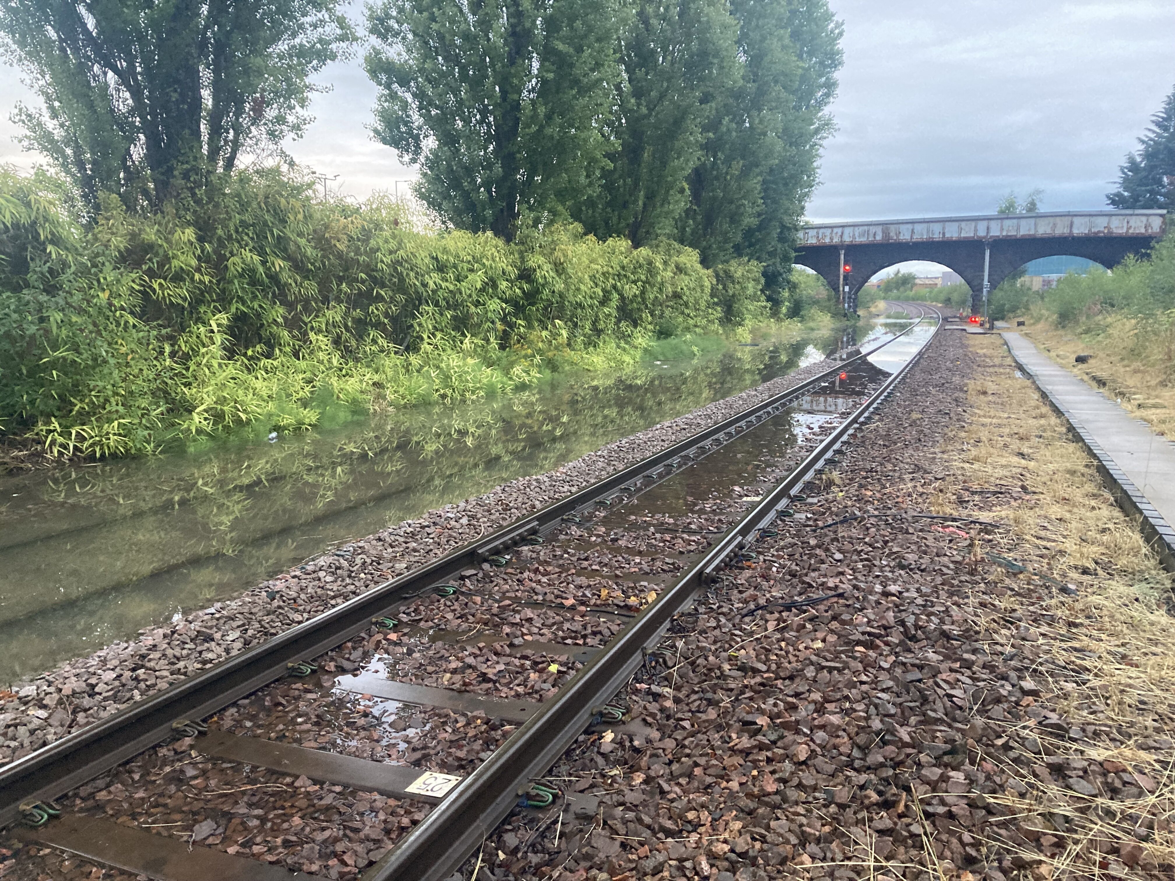
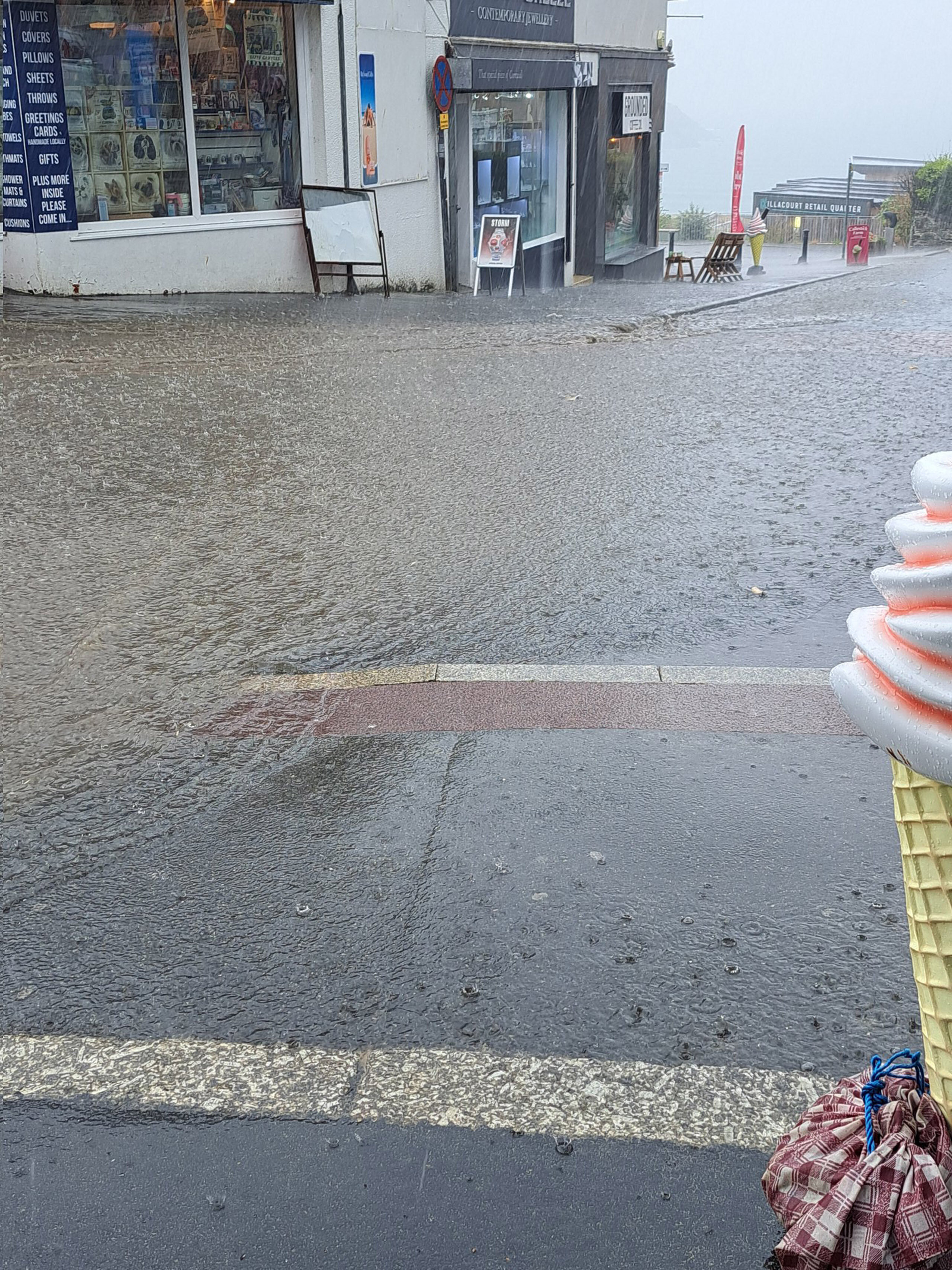
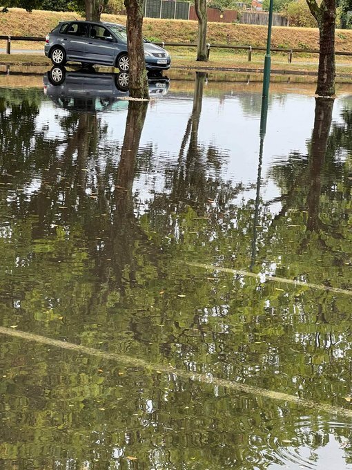
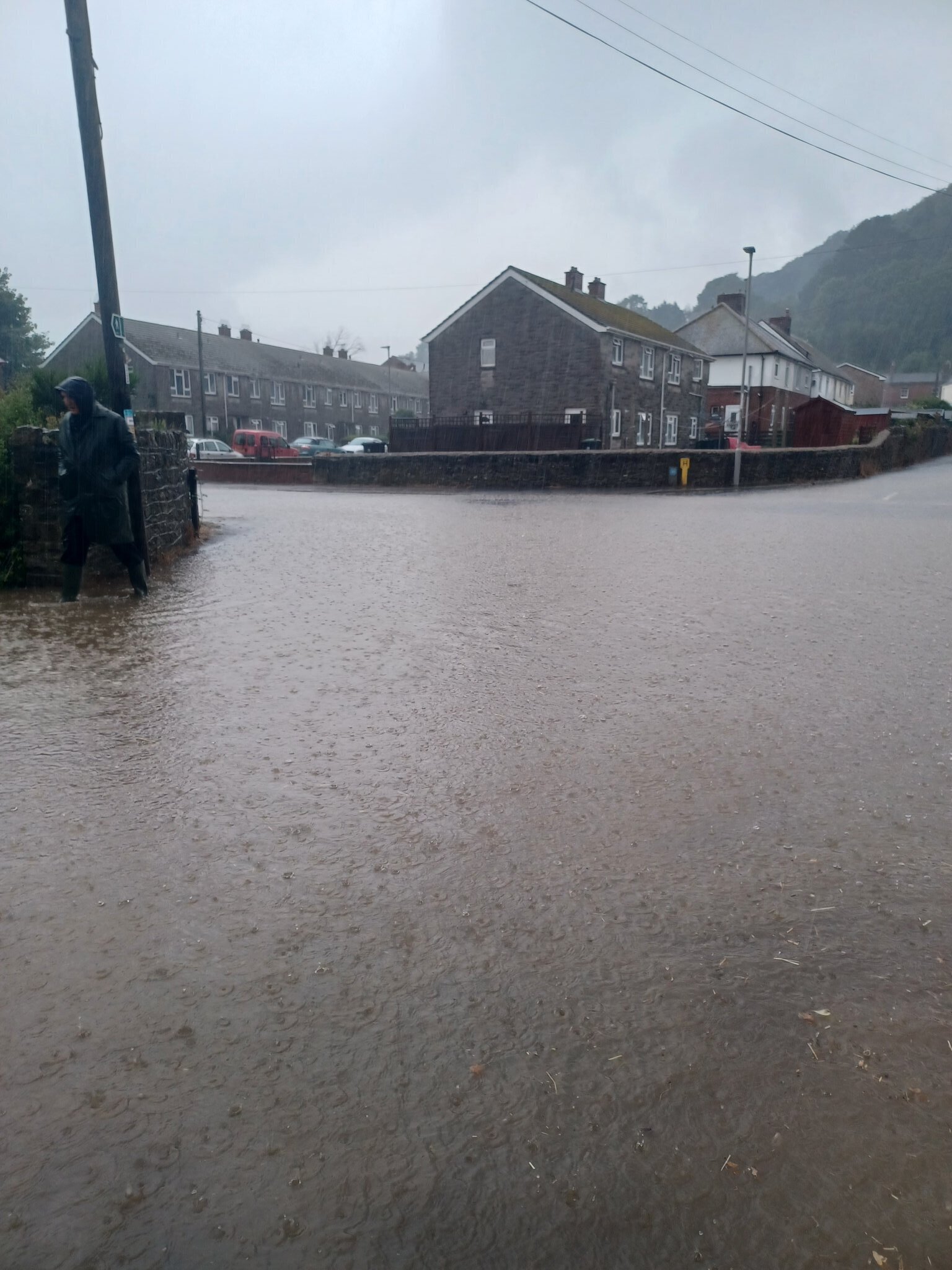
Footage and photos showed torrential rain and floodwater sweeping through towns across the UK.
The Met Office issued an amber thunderstorm warning from 11am until 10pm on Wednesday, meaning people should expect flooding and disruption.
The warning says: “Fast flowing or deep floodwater is likely, causing danger to life.”
Flooding is likely to affect homes and businesses “quickly”, as 30mm to 50mm of rain could fall in just an hour, while a few places may see more than 100mm in a few hours.
Forecasters say this could lead to train and bus cancellations amid difficult driving conditions, power cuts and communities becoming cut off from roads.
Lightning, hail and strong winds will also lash areas included in the warning, which spreads across Suffolk, Kent, Surrey and West Sussex.
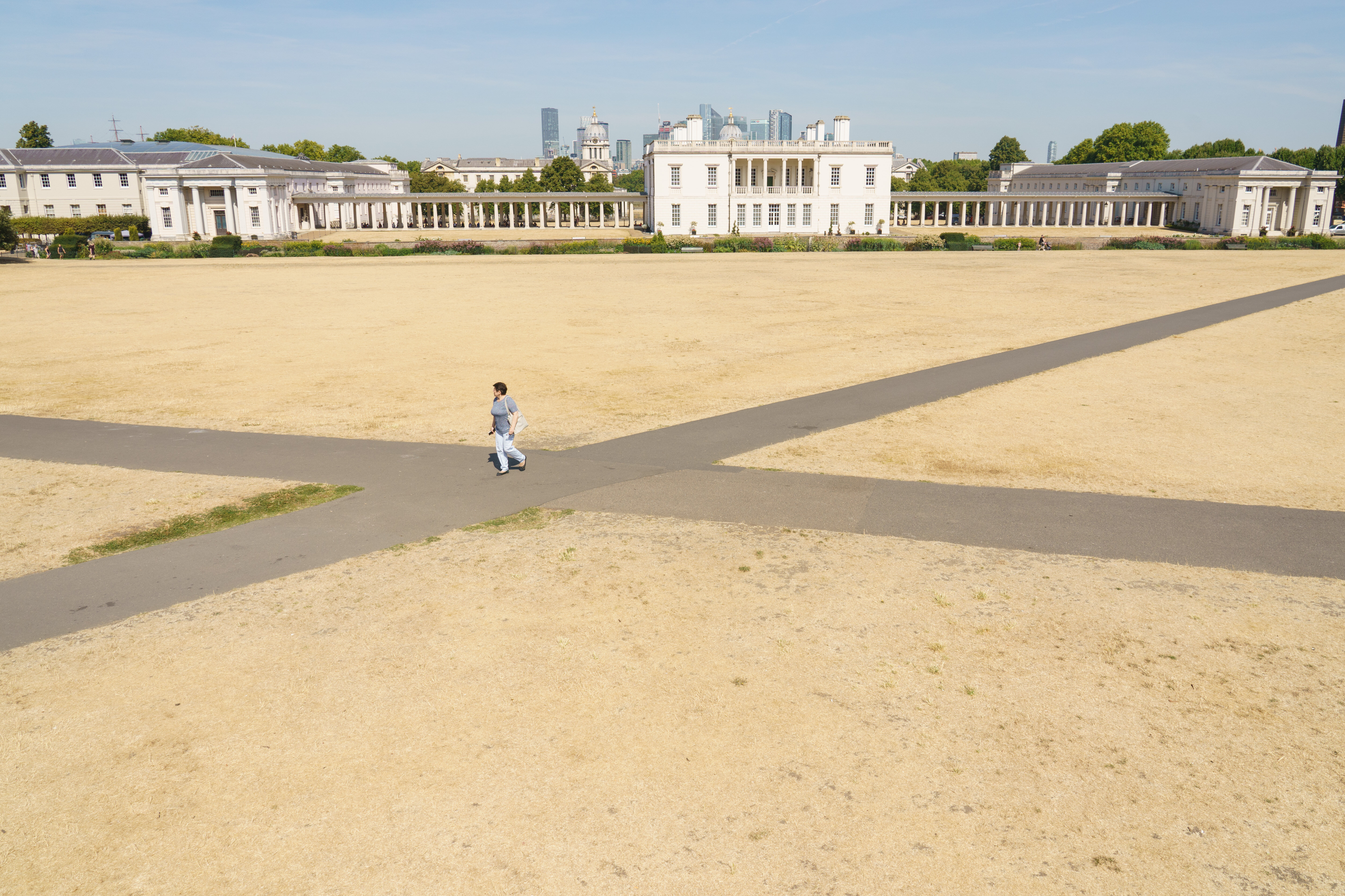
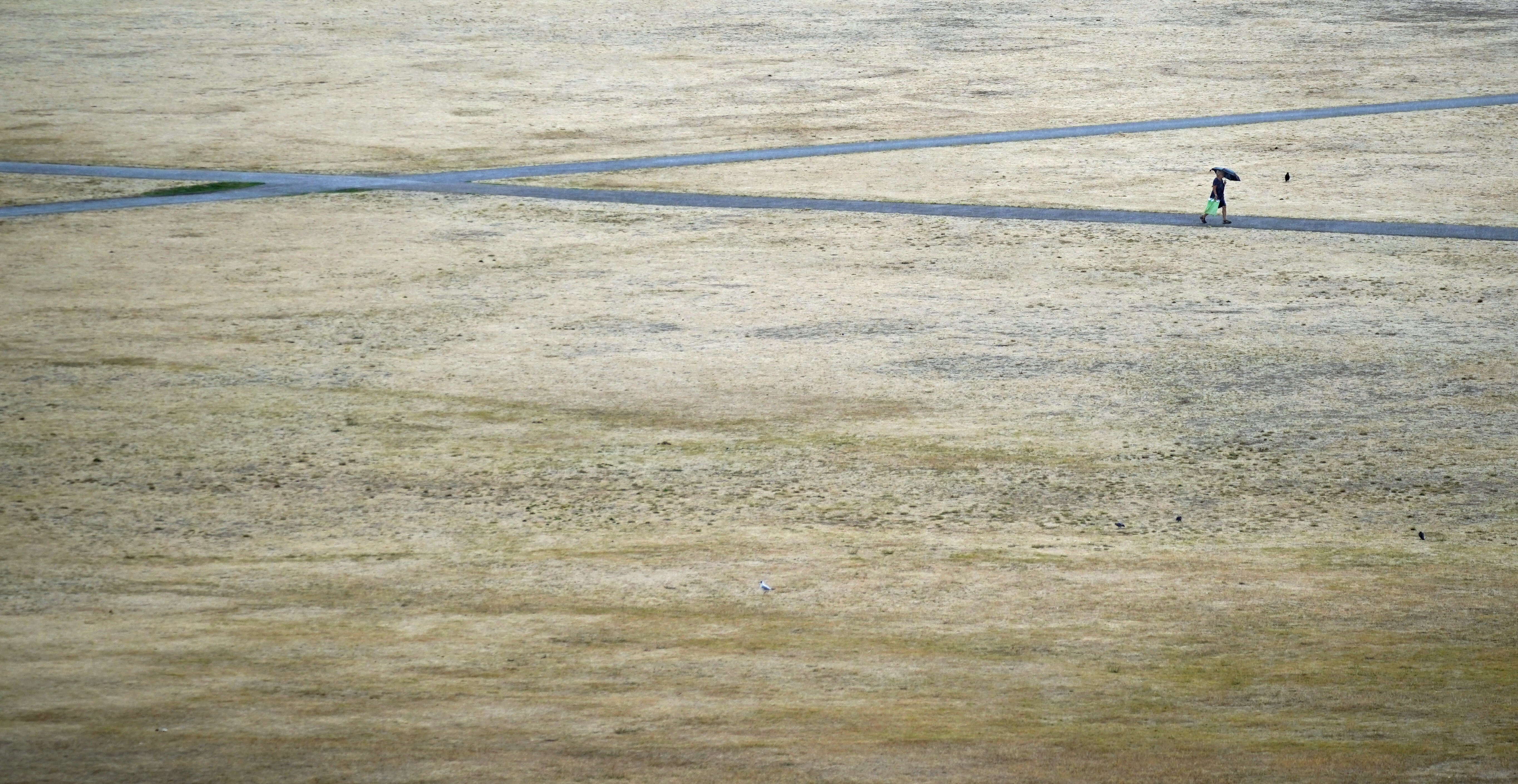
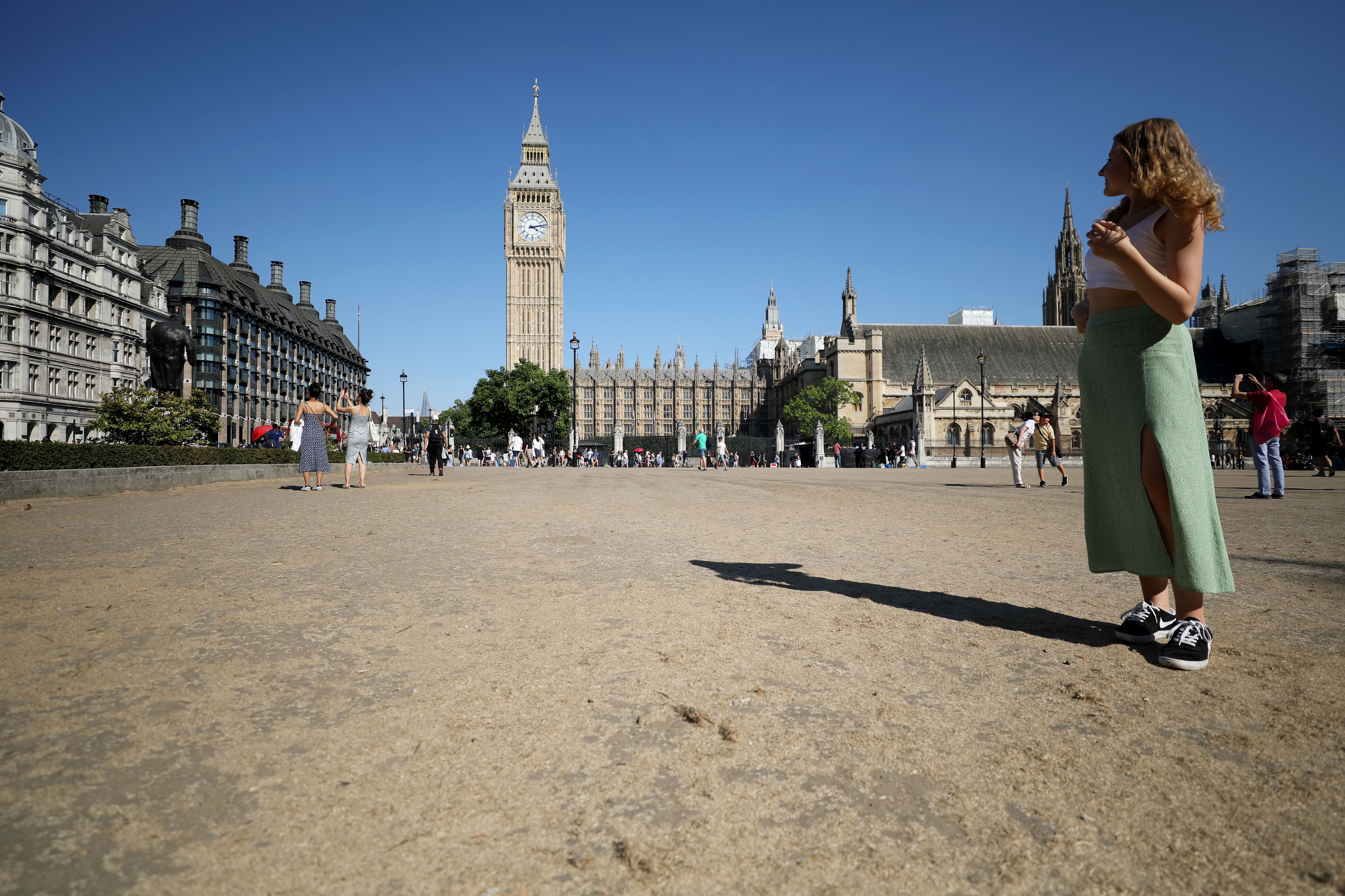
The images of floods emerging are in stark contrast to last week, when England’s green pastures had been turned yellow and brown.
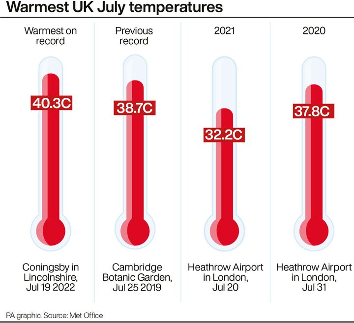
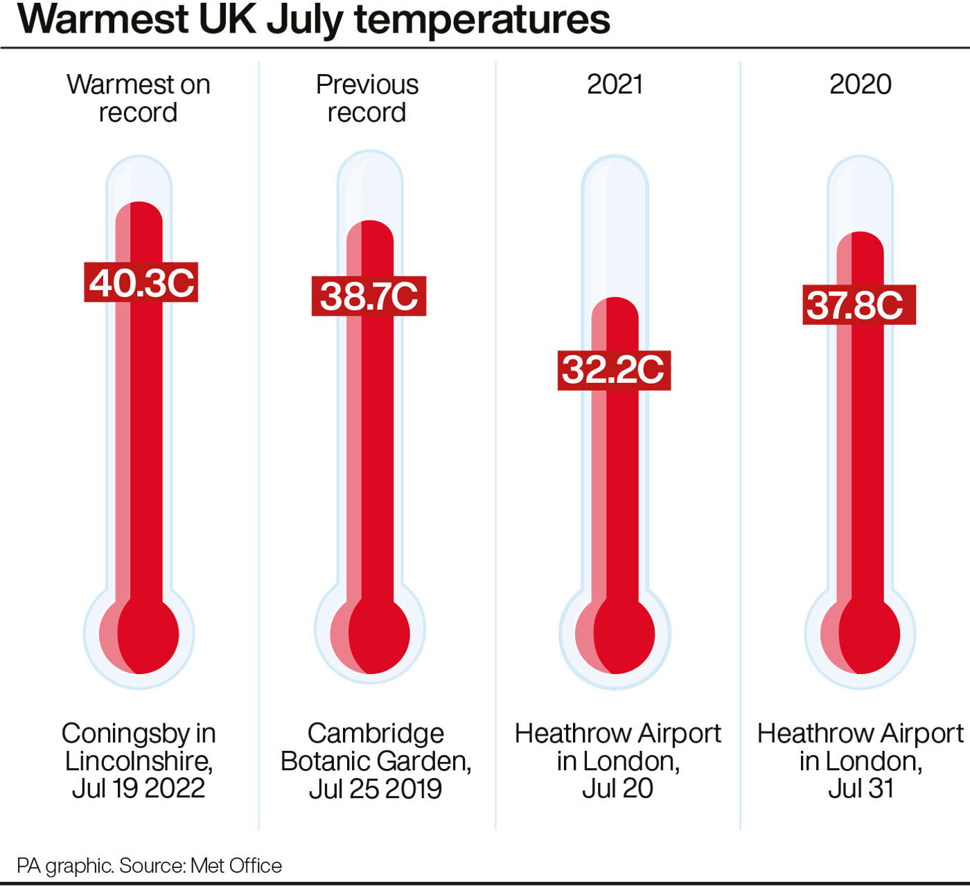
A drought was officially declared across most of England following the driest July for 50 years and the driest first half of the year since 1976.
Thames Water, which supplies 15 million people, is putting a hosepipe ban in place next week, saying water levels in its reservoirs were “much lower than usual”.
It joins Welsh Water, Southern Water and South East Water in implementing a hosepipe ban.
South West Water and Yorkshire Water will follow suit on August 23 and 26 respectively – meaning more than 29.4 million customers across the UK will be prohibited from using hosepipes by the end of next week.
While this is obviously caused by the climate crisis, here’s everything you need to know to understand how it is really affecting our day to day lives.
PA Graphics via PA Graphics/Press Association Images
What caused the hot weather?
The extreme weather which spread across the UK in July was caused by a surge in continental air and August’s heatwave has been caused by a “stubborn area of high pressure sat over the UK”, a Met Office spokesperson told HuffPost UK.
Advertisement
A heat-health alert from the UK Health Security Agency is also still in place until 9am on Tuesday.
The heatwaves have made the UK so dry, that an official drought was declared in eight areas of England on Friday by the National Drought Group.
Welsh Water, Southern Water, and South East Water have brought in hosepipe bans too, while Yorkshire Water and Thames Water are planning to bring them in soon.
The Met Office also believes, despite the coming rain, this summer will be remembered as a particularly dry one.
The chair of the National Fire Chiefs Council, (NFCC) Mark Hardingham said: “I can’t remember a summer like this and I’ve been in the fire service 32 years. We are not going to see temperatures as hot as we saw three weeks ago but that doesn’t matter because the ground couldn’t get any drier than it already is.”
Will there be rain?
Not just rain, but storms too. Locations in Northern Ireland and Scotland are already seeing thundery skies, meaning the Met Office has issued some yellow thunderstorm warnings. Storms are expected to hit the south by Wednesday.
Advertisement
Three days of heavy rain are expected in total, potentially accompanied by hail, sweeping in an eastern direction across the country.
The Met Office expects to see at leat 50mm of rain in two or three-hour periods in a few regions, putting low-lying roads and areas next to sloping fields at risk.
But, the rain recorded from the rest of the summer in parts of southern and central England is less than a quarter of what is usually expected in a British summer.
By Thursday, high pressure will have pushed into the UK and so it will stay mostly dry.
Is this rain good or bad?
Well, there hasn’t been substantial rainfall since June in many southern regions.
But there are fears that the intense dry spell – lasting several weeks now – means the land is too dry to absorb the rainwater.
Advertisement
There could therefore be flash flooding, but the rain will do little to ease drought conditions. The thunder could could cause power cuts too.
However, rain does still reduce the threat of wildfires which have strained UK fire services over recent months.
The Met Office’s Dan Stroud said what we really need is “an extended period of light rain, an average or slightly above average autumn”, along with a winter where constant light rain recharges the ground.
Discussing the upcoming downpour, Stroud said: “It will help a little but to be honest really, it’s almost the wrong kind of rain. What we’re likely to see is some heavy, intense downpours.
“With the ground baked so dry, it’s very difficult for the ground to actually absorb the water very quickly… so what tends to happen in these circumstances is the water runs off, and we can potentially get some surface run-off issues, so some flash floods.”
Advertisement
Why is our weather changing so quickly?
Short answer: climate change.
In terms of why this week in particular seems so dramatic, meteorologist Stroud said the drastic changes stem from an alteration in air pressure.
Stroud said: “We’ve had a number of days now where we’ve had clear, strong skies and strong sunshine which has heated up the ground.
“We’ve had high pressure dominating, now we’re having low pressure dominate, so the air is becoming more unstable.
“As we’ve had some very high ground temperatures, it doesn’t actually take too much for the air to become even more unstable and for thundery showers to develop quickly.”
Heavy, thundery rain at first across Northern Ireland and Scotland this Monday morning
Drier elsewhere, but thundery rain soon spreading from the west, feeling very warm and muggy for many pic.twitter.com/gVXOzUrduE
Probably not. The climate crisis is not going anywhere, and is actually getting worse, as our atmosphere continues to heat up.
Temperatures are expected to decrease to a more normal level in August, but that doesn’t mean we can’t expect similarly searing heat next summer.
As professor Hannah Cloke, a natural hazards researcher at the University of Reading told the i newspaper: “With average temperatures rising across the UK, we have to shift the definition of what ‘particularly hot’ is, otherwise that definitely becomes increasingly meaningless.”
She said the UK needs to change how we define a heatwave, as rising greenhouse gas emissions mean higher temperatures are more common now than they were over the last two decades.